
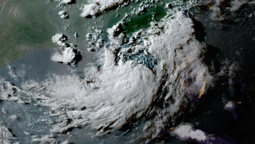
Tropical Storm Bertha has emerged in the northeastern Gulf, with its trajectory likely to impact parts of the Gulf Coast stretching from Florida to Louisiana, potentially extending to Texas.
The storm could bring heavy rainfall, coastal flooding, and winds associated with tropical storm conditions. On Monday afternoon, some bands of intense rain were already moving into the Florida Panhandle.
The second named storm of the 2026 Atlantic hurricane season has recorded winds of 40 mph, and further intensification is possible.
🌀 ⛈️Check out the latest storm track and intensity projections on the USdaily Weather app
A tropical storm warning has been issued for the coastal areas of Alabama, Mississippi, and eastern Louisiana. These regions should prepare for tropical storm conditions within the next 36 hours.
A tropical storm watch is in effect for the western coast of the Florida Panhandle and the eastern half of the Louisiana coast, including New Orleans, where tropical storm conditions may arise within the next 24 to 48 hours. Additional alerts could be announced further west along the Louisiana and Texas coasts in the coming days.
Although designated as a tropical storm, Bertha remains somewhat disorganized, with persistent thunderstorms predominantly in its southern section. The presence of dry air and the storm’s expansive size have hindered its development into a more robust tropical system, despite being fueled by almost record-high Gulf water temperatures.
Compared to previous years, this Atlantic hurricane season has begun slowly, largely due to El Niño’s influence over parts of the basin.
The National Oceanic and Atmospheric Administration forecasts a below-average number of named storms in the Atlantic this season as a result of this phenomenon.
Storm Track and Intensity
Bertha is likely to move along the Gulf Coast and make landfall as a weak tropical storm late Wednesday night, primarily affecting southeast Louisiana and southern Mississippi.
Several elements will limit Bertha’s intensification. Typically, tropical systems weaken when they approach land due to a lack of warm water that sustains their thunderstorms.
Additionally, Bertha might encounter even greater wind shear than it is currently facing. Wind shear refers to the variation in wind speed or direction from the ground level to higher altitudes, which can disrupt a storm’s structure.
Depending on the severity of the surrounding atmospheric conditions, the storm might even dissipate over Louisiana. Nevertheless, the latest forecast from the National Hurricane Center suggests it could reach the Upper Texas Coast as a tropical depression by the end of the week.
Anticipated Impacts on the Gulf Coast Starting Monday
Regardless of the storm’s eventual outcome, the northern Gulf Coast can expect heavy rainfall, strong winds, and some coastal flooding from Monday night through at least the middle of the week.
For those near the coast, the wind shear is impacting the northern part of Bertha more significantly, which should help to keep the heaviest rainfall offshore.
Here’s what to anticipate:
• Rainfall: Widespread accumulations of 2 to 4 inches are likely, with isolated areas receiving up to 8 inches during the most intense thunderstorms across the western Florida Panhandle to southern Alabama, Mississippi, Louisiana, and possibly the Texas coast. This could lead to flash flooding, particularly in urban environments like New Orleans.
• Wind: Tropical storm conditions, including sustained winds of 39+ mph, are possible along the Alabama, Mississippi, and eastern Louisiana coasts under a tropical storm warning from Monday night into Tuesday. Areas in the western Florida Panhandle and coastal Louisiana under a tropical storm watch may experience these conditions late Tuesday night into Wednesday. Higher gusts during thunderstorms could result in isolated power outages.
• Storm surge: Water levels could rise by 2 to 4 feet above normal from the mouth of the Mississippi River in southeast Louisiana to the border of Alabama and Florida. A storm surge watch is currently in effect for this region, indicating that life-threatening inundation from ocean waters could occur within the next 48 hours.
